


SORA Technology Launches Joint Research at a Mine in Mozambique with Hokkaido University, ISPT, and ICVL
SORA Technology Co., Ltd. (Headquarters: Nagoya, Japan; Founder & CEO: Yosuke Kaneko; hereafter “SORA Technology”), which provides advanced drone and AI solutions across public health, agriculture, and climate resilience, conducted drone-based aerial surveys to collect RGB and multispectral data at a mining site in Tete Province, Mozambique.
Using the data collected through these surveys, SORA Technology has launched a joint research project with the Resource Management Lab. at Hokkaido University (hereafter “Hokkaido University”); Instituto Superior Politécnico de Tete (ISPT), located in Tete City, Tete Province, Mozambique; and International Coal Ventures Limited (ICVL), which operates large-scale coking and thermal coal mines in the province.
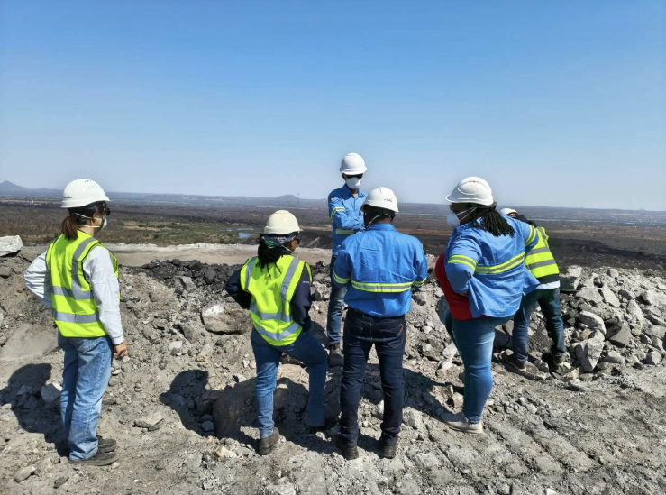
Discussing the drone flight plan (Photo by Hokkaido University)
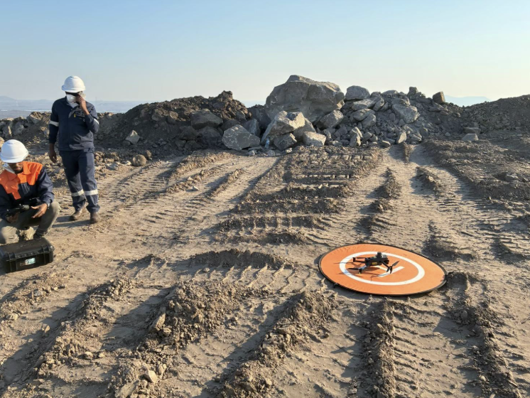
Drone taking off for an aerial survey (Photo by Hokkaido University)
Mining regions across Africa require continuous access to high-resolution geospatial data for environmental impact assessments associated with resource development and for evaluating the stability of open-pit mine slopes. However, conducting drone surveys directly in the field poses significant practical challenges for research institutions, including international travel, equipment transportation, obtaining flight permits, and securing qualified local drone operators. As a result, obtaining data with the required accuracy at the right time has not always been easy.
Through this collaboration, SORA Technology, which has developed drone operations and local operational networks across multiple African countries, will provide aerial survey data, including RGB and multispectral imagery, as well as three-dimensional point cloud data generated from aerial imagery. This data will enable research into slope stability assessment through 3D modeling of the mining site, environmental assessment through monitoring of vegetation and surface changes, and analysis of geological characteristics.
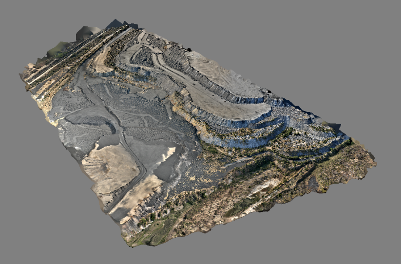
3D model data generated from the aerial survey (Photo by Hokkaido University)
Satellite data will be used to capture a comprehensive, area-wide view of the entire mining site and analyze historical time-series data to identify large-scale changes such as deforestation and surface alterations. Based on these findings, priority areas requiring closer investigation will be identified and surveyed in detail using small drones for high-precision, site-specific measurements. AI-based analysis will then be applied to the satellite and drone data to automatically detect features such as deforestation and geological characteristics.
This approach will enable mining operators to identify potential slope failure risks at an early stage, enhance operational safety, and develop more efficient mining plans based on high-precision resource surveys. In addition, sharing objective, data-driven environmental assessment results among government authorities and local communities will help foster mutual understanding of mining development. Through these efforts, the project aims to advance “green mining,” where resource development and environmental conservation can coexist.
Comment from Yosuke Kaneko, Founder & CEO of SORA Technology
“For researchers, mining sites in Africa have long been places they want to study but where obtaining the necessary data can be extremely challenging. The local drone operations network we have built through our malaria control initiatives across Africa is a valuable asset that can directly help overcome this barrier. We are very pleased to contribute to this research by providing locally collected data. Looking ahead, we will continue to expand our academic collaborations so that data captured from “SORA” (“sky” in Japanese) can help shape a blueprint for a future where resource development and environmental conservation go hand in hand.”
Company Profile
Company Name: SORA Technology Co., Ltd.
Headquarters: 2-14-1 Nagono, Nishi-ku, Nagoya, Aichi, Japan
Representative: Yosuke Kaneko (Founder & CEO)
Established: 2020
Business: Development and provision of drone- and AI-powered technologies for infectious disease control, agricultural support, and climate adaptation.
Mission: SORA Technology is committed to the mission of “Transforming lives from the sky (SORA).” By leveraging advanced drone and AI technologies, the company aims to help build safe and prosperous societies anywhere in the world. Centered in Africa and other developing regions, SORA provides a wide range of services, from infectious disease surveillance and control to agricultural productivity enhancement and climate adaptation support.
LinkedIn: https://www.linkedin.com/company/sora-technology/
Facebook: https://www.facebook.com/sora.technology/
